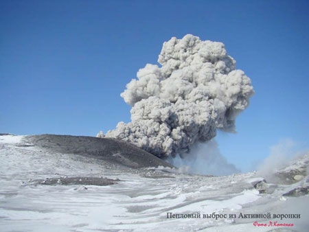
Ebeko Volcano
|
||||||||||||
| Location | ||||||||||||
The volcano is located in the northern part of Paramushir Island, 7 km to the west-north-west from Severo-Kurilsk.
|
||||||||||||
| Form and structure | ||||||||||||
The complicated volcano belongs to the type of “Somma-Vesuvy” and is nested on the volcanic ridge of Vernadsky. Somma 3-5 km in diameter is destroyed. The summit of the central cone extending in the meridional direction has three adjoining craters with diameters 250-300 m and depths 70-100 m. There are a lot of flank craters with centers of fumarolic and hydrothermal activity. |
||||||||||||
| Composition | ||||||||||||
| Andesit-basalts and andesits | ||||||||||||
| Age | ||||||||||||
| 2400 years | ||||||||||||
| Aviation color code |
GREEN |
| Last VONA/KVERT Releases |
| Hazard synopsis |
Potential hazards are caused by ash plumes, ash falls, lahars, clouds of sulphuretted hydrogen and sulphureous gas.
Ash plumes (up to 5 km a.s.l.) of the volcano are dangerous to airport in Severo-Kurilsk and local airlines. Ash falls possible at: Severo-Kurilsk (7 km to the east-south-east from the volcano) Ozernovskiy (90 km to the north-north-east) |
| Monitoring status |
web video camera, satellite, visual
|
